🪂 Club XC plannerJoinSign in

Seeing the air over the hill: rotor and sink

Choose a wind and watch how the air follows the ground: where it lifts, where it sinks and where it gets rough.

Set the wind

Pick a site, a wind direction and strength, how stable the air is, and the height you'll be flying at. The page models how the wind flows over the terrain and colours it: green for ridge lift, red for sink, orange for turbulence, and rolling loops where rotor forms behind a crest. At Millington it uses the Environment Agency's LiDAR terrain at 3-metre resolution near the hill.
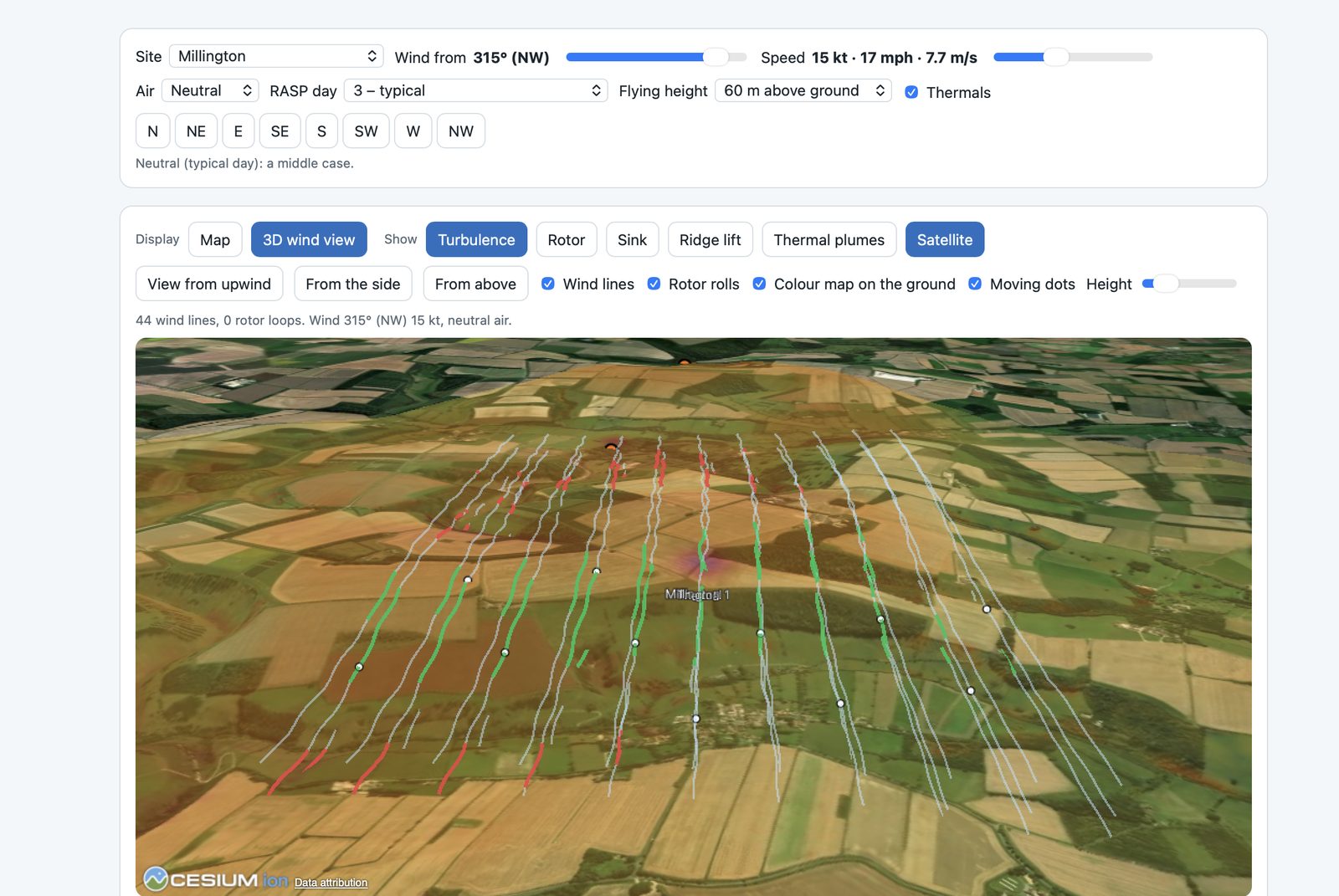
Millington in a 15 kt north-westerly, neutral air: 44 wind lines over satellite imagery. Green where the air rises up the face, red where it sinks behind; no rotor loops for this wind.

The side-on view

Click the map and you get a slice through the hill along the wind, stretched vertically so the shape shows. Blue lines show how the air roughly follows the ground, arrows mark lift and sink, and orange ticks show where to expect turbulence.
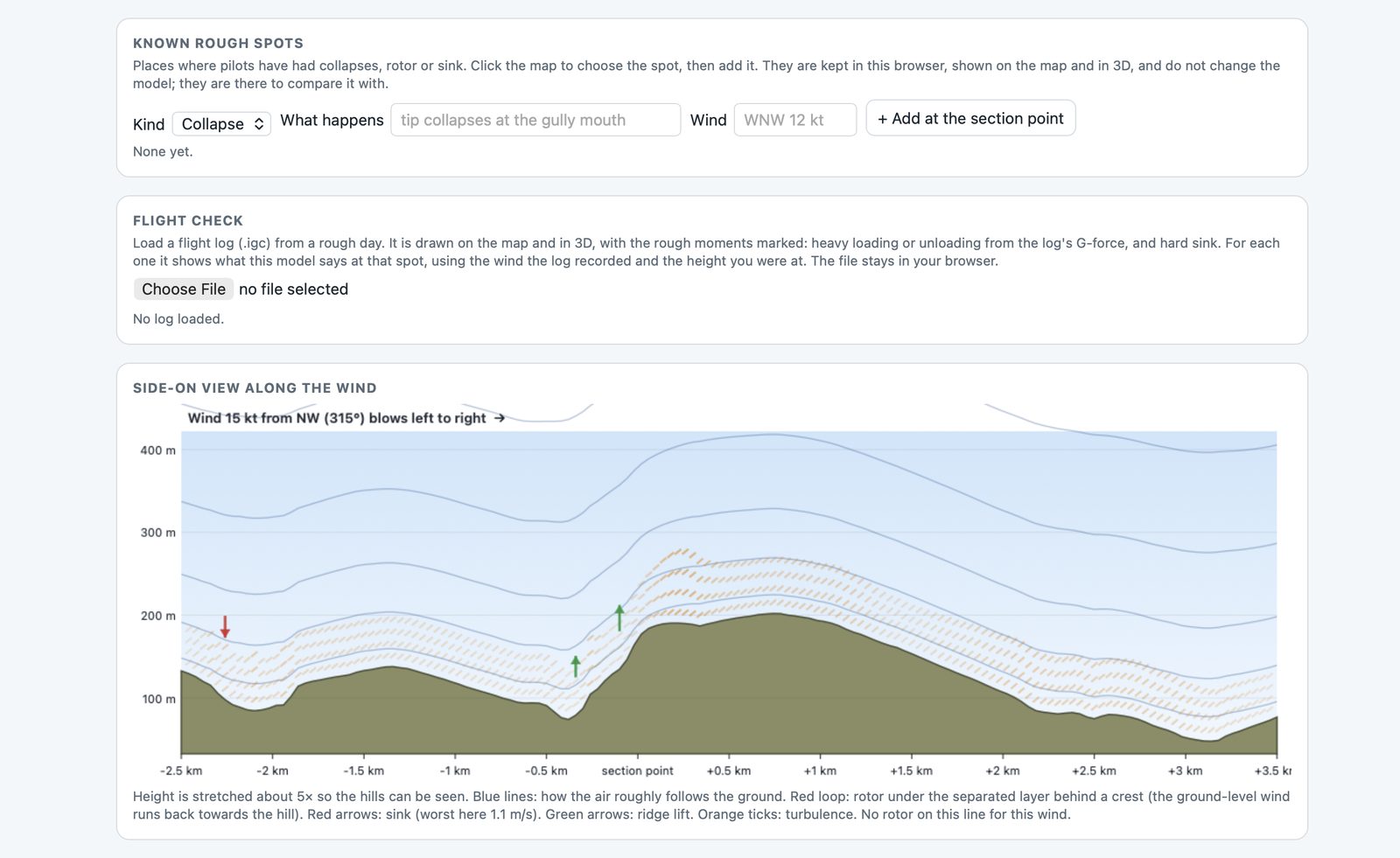
Side-on along a 315° wind at 15 kt. Green arrows: ridge lift on the windward face. Red arrow: sink up to about 1.1 m/s in the dip upwind. Orange: turbulence in the lee. No rotor on this line for this wind.

Known rough spots and flight checks

Pilots can mark known rough spots (a collapse, rotor or sink, and the wind at the time) to compare with the model. Flight check loads a log from a rough day, marks heavy loading and hard sink from the log itself, and shows what the model says at each of those moments.

It's a simplified model of airflow, not a wind-tunnel test. Real rotor depends on stability, gusts, trees, buildings and thermals that no model here captures. Use it to understand a site's shape and to talk about it, not to decide whether a day is safe.
Want to try it? Message me and I'll give you a demo on one of your own flights. You choose who sees each flight you upload: the club, the club without your name, or only you.