Plan the day.
Learn from the flight.
Flight analytics, XC planning, a thermal trigger map, rotor & sink and 3D replay. You can find some of these tools elsewhere; here they all work together, on the same flights and the same sites.
Runs in your browser. No app to install. A planning aid, not a go/no-go tool.
How it works
Add your flight
Drop an IGC file in the browser, or send it from the phone app. Local flights are fine.
See what happened
Turn circle, climb rate and consistency, thermals left early, a 3D replay, and where each climb started on the ground.
Plan the next one
Forecast thermals and RASP, where to find lift, a suggested route, and the rotor and sink to avoid.
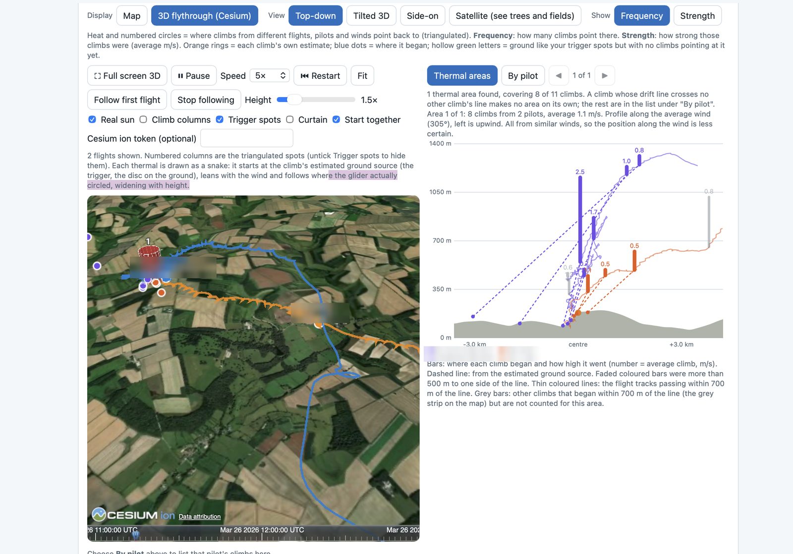
Where do our thermals actually start?
A thermal leans with the wind, so the climb you find at 400 m may have left the ground a kilometre upwind. The planner traces every climb back to its source, and lets many flights pin the spot down.
- Drift measured from your own circles
- Lines from different pilots, days and winds cross at the real trigger
- Slope, aspect, sun and terrain shape for every source
- 3D flythrough with each thermal rising from the ground
- "Places worth checking": ground like the spots that work
Everything in one place
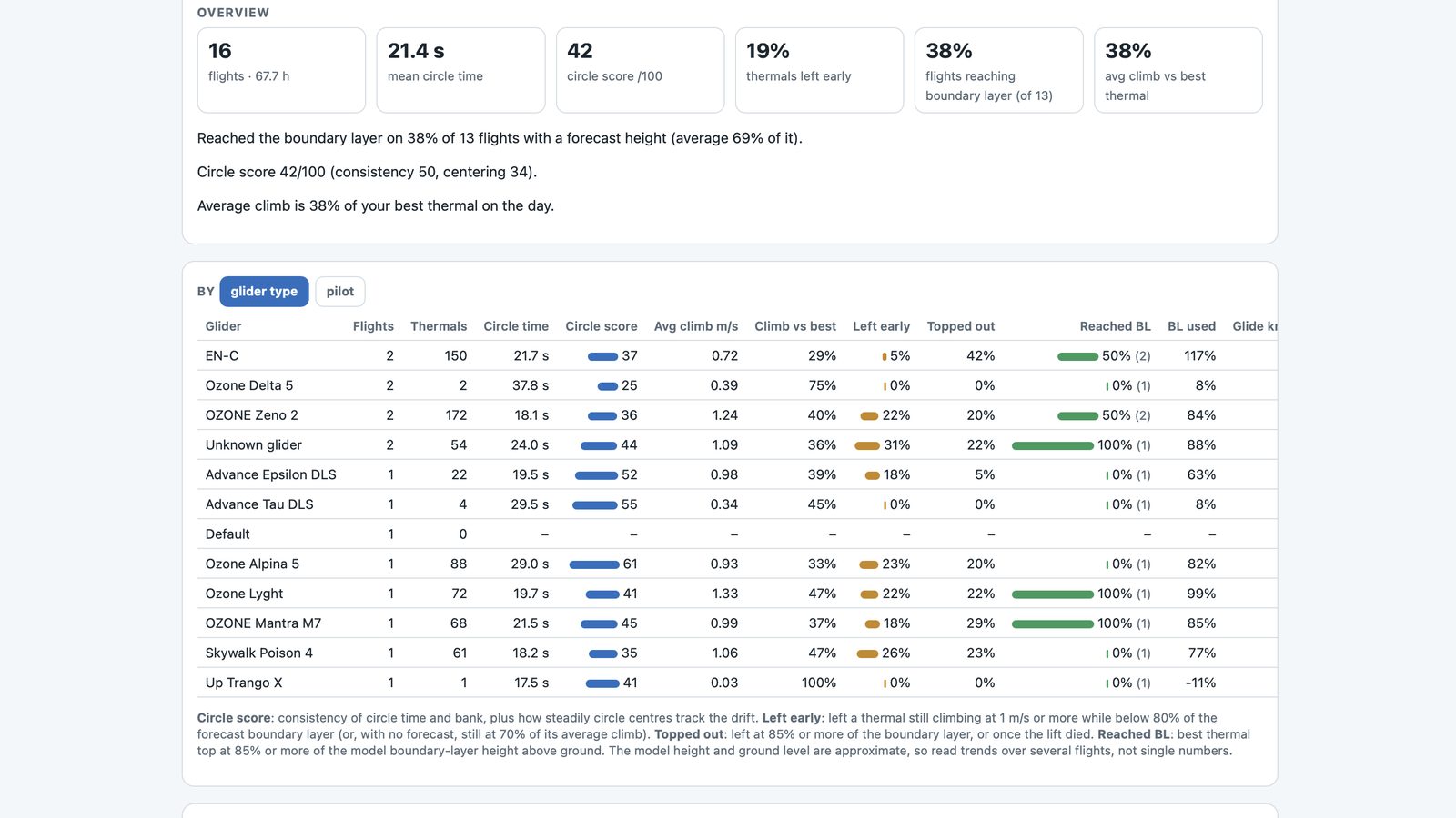
Flight analytics
Turn circle, climb rate, climb consistency, thermals left early and glide speed, from any IGC file.
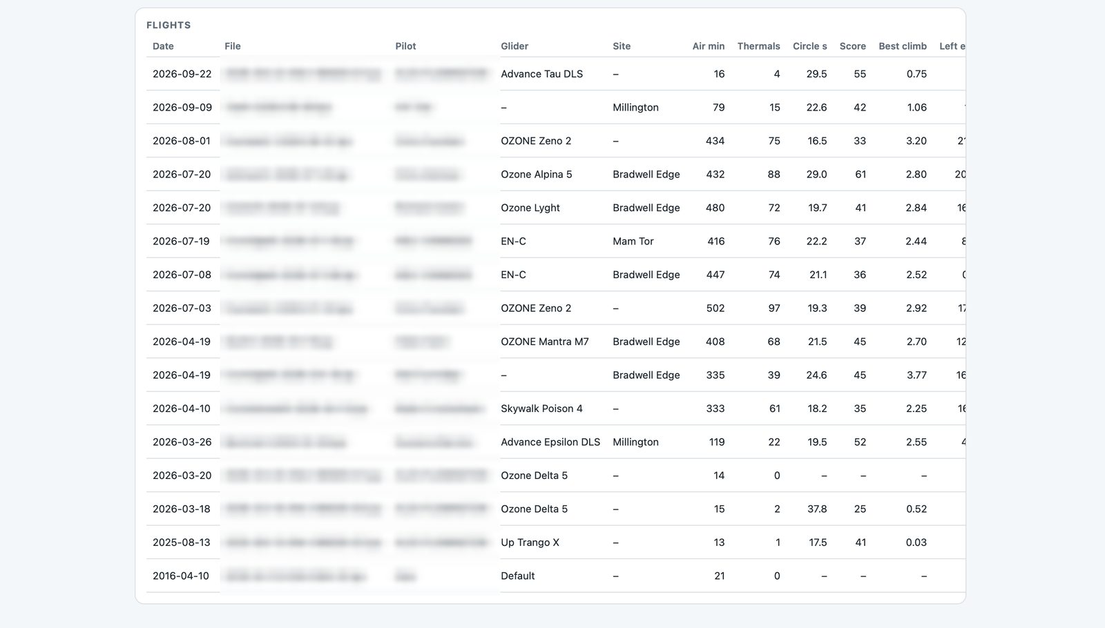
Advanced analytics
Flights side by side, the lead-pilot view, lift you flew through and pointers for next time.
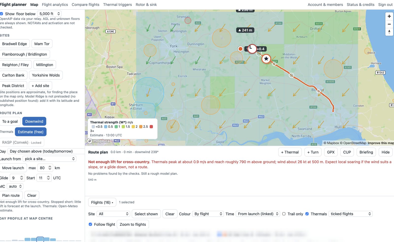
XC planner + RASP
Forecast thermals, cloudbase and convergence, then a route with speed to fly and arrival heights.
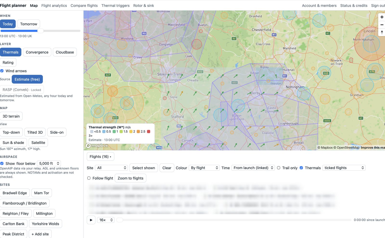
Where to find thermals
Forecast cells, sunlit slopes, trigger spots and the club's own hotspots in one view.
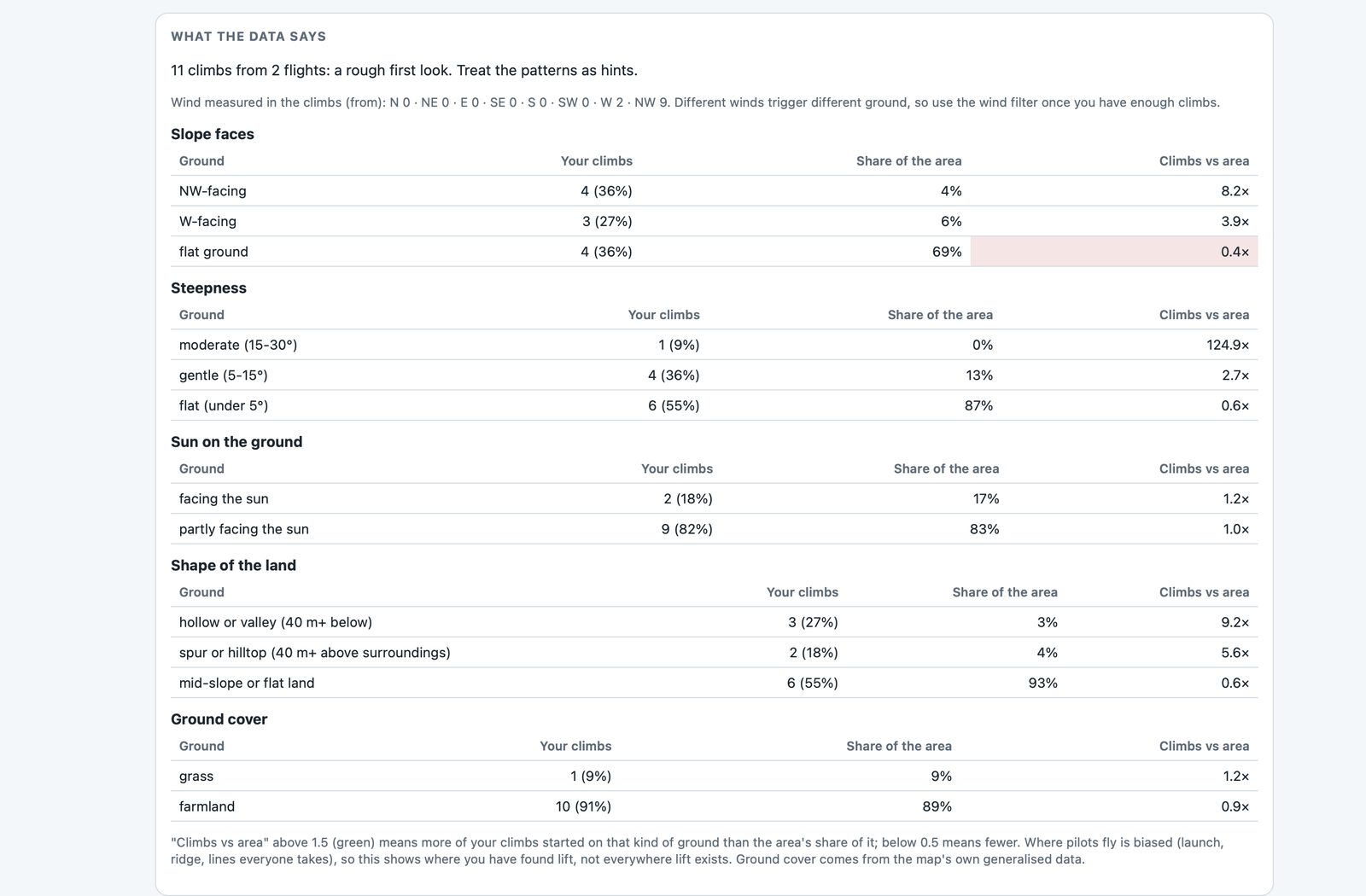
Thermal trigger map
Every climb traced back to the ground, so the real trigger spots show up.
3D playback
Flights over satellite terrain, each thermal rising from where it started.
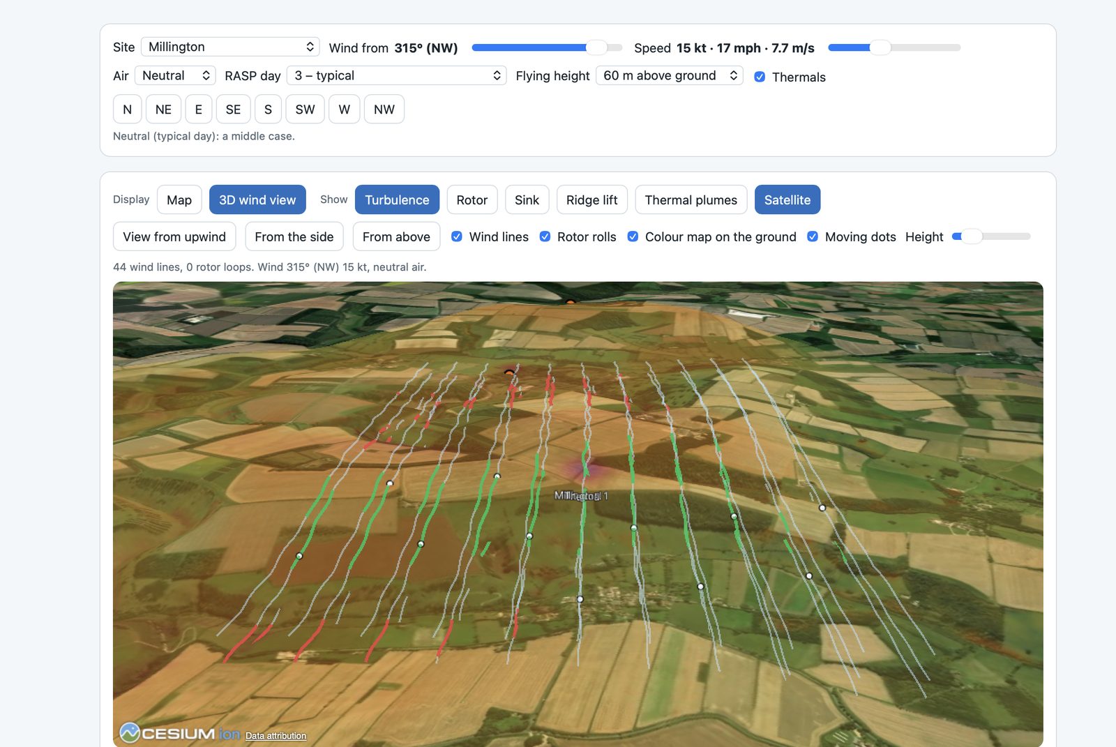
Rotor & sink
Ridge lift, sink, turbulence and rotor for any wind, with LiDAR at Millington.
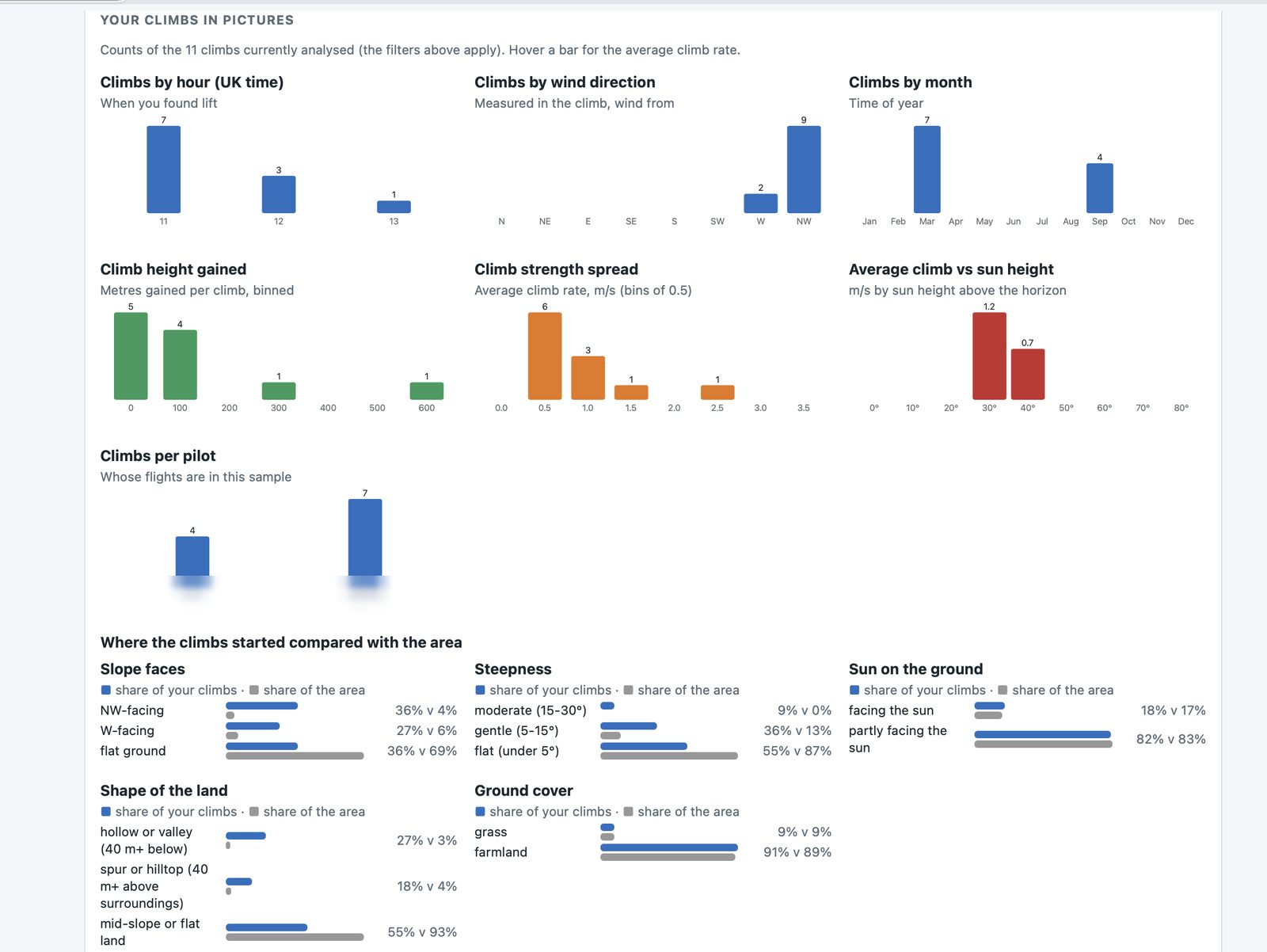
Your climbs in pictures
When, where and in what wind your climbs happen, and what ground they come from.
The first test flights
November 2026
Sites so far
- Bradwell Edge5
- Millington2
- Mam Tor1
- Other launches8
The more flights go in, the better the thermal map gets for everyone.
Built around four questions
Is today on?
Hour-by-hour thermal strength, cloudbase and convergence, with RASP where available and airspace filtered by height.
Which way, and how fast?
A suggested route with speed to fly, arrival heights, terrain and airspace checks, and GPX or CUP export.
Where's the next climb?
Sunlit slopes, trigger spots, the club's hotspots and places worth checking.
How did I do?
Your turns, climbs and glides, side by side with others, with pointers for next time.
Join
Everything in one place: the forecast map and route planner, flight analytics, My coach, thermal triggers, rotor & sink and the 3D replay. Pay through PayPal and cancel any time.
Payments are handled by PayPal; card details never reach this site.
Interested?
Just message me and I'll give you a demo on one of your own flights.
Already testing? Sign in